AIMS
  • Historical GIS on the history of European Historiography since 1800
  • Thematic maps showing the institutionalization and professionalization of the historical sciences
  • Political map of Europe for eight time periods: 1830, 1850, 1878, 1900, 1928, 1955, 1980, 2005
  • Development of open, substainable and reusable workflows, data models, software modules and interfaces
INSTITUTIONS FOR HISTORICAL SCIENCES
  • Academies and independent research institutions
  • Archives and their opening for the Historical Sciences
  • Historical Museums
  • Historical Societies and Associations
PROFESSIONALIZATION OF THE HISTORICAL SCIENCES
  • University Chairs for Historians
  • From 1928: All tenured positions for historical sciences at universities and research institutions including information to
    • name
    • position
    • gender
    • teaching/research period
PRINTED EDITION

Atlas of European Historiography
The Making of a Profession
1800-2005

Ed. by
Ilaria Porciani und Lutz Raphael
(Writing the Nation, 1)
Basingstoke 2010

DATA
  • Event-based data model for persons, institutions, and places
  • Geo module /API for historical-geographical informationen
    (GeoJSON)
  • Links to Authority Files
    and Linked Open Data (GND,
    VIAF, Wikidata etc.)
CODE
  • Integration of Openlayers to display space-time relations (Angular7)
  • Geo-Processing (Python)
  • Project-specific configuration of FuD-API (NodeJS)
GEOCODING
  • Semi-automatic map generation
    (UMN Mapserver,
    Python)
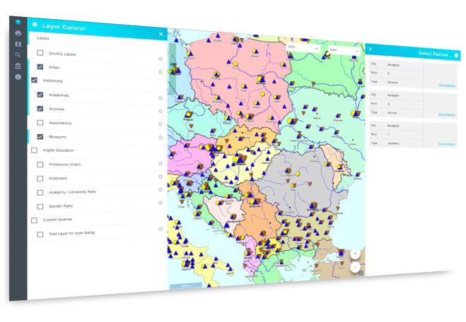
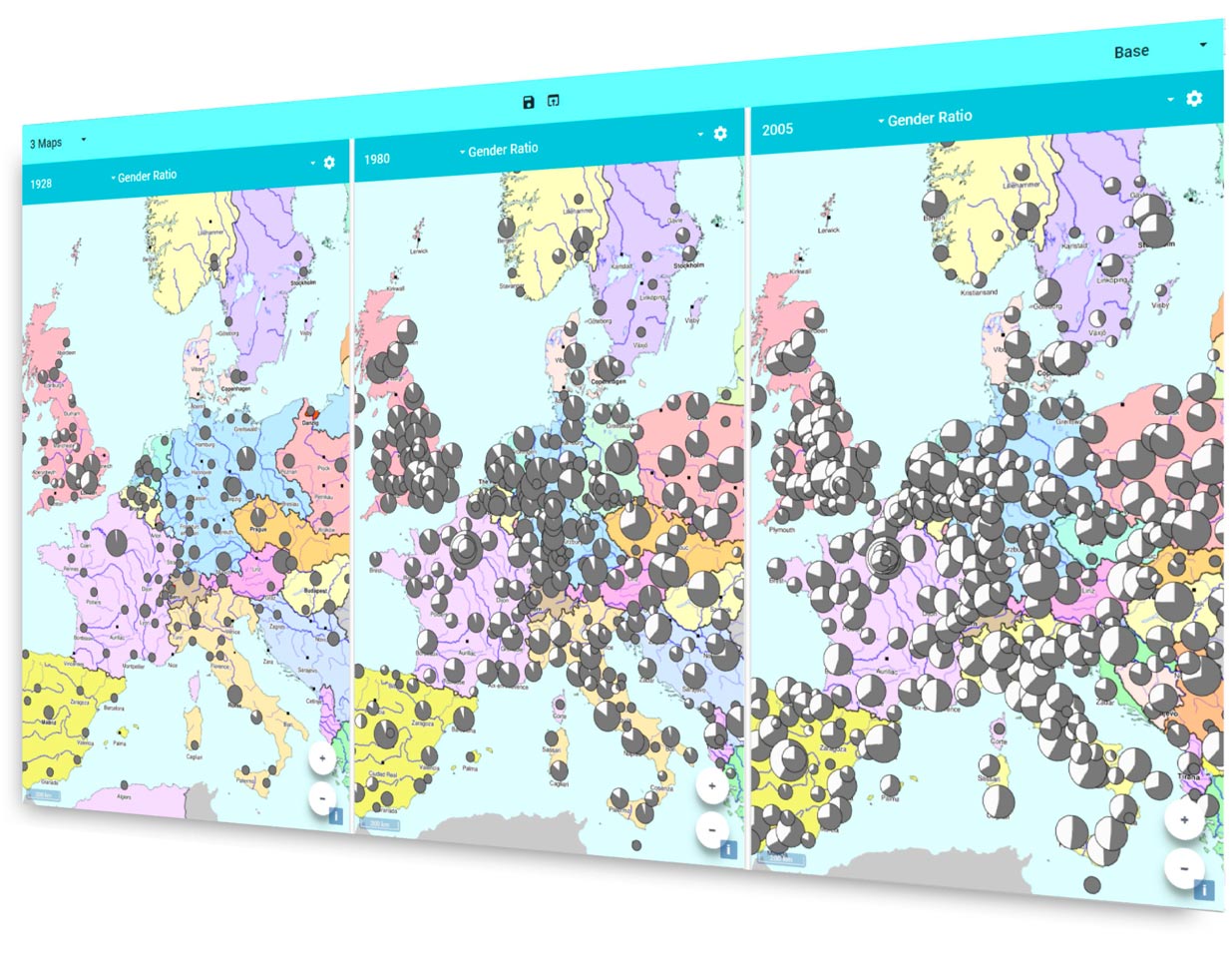
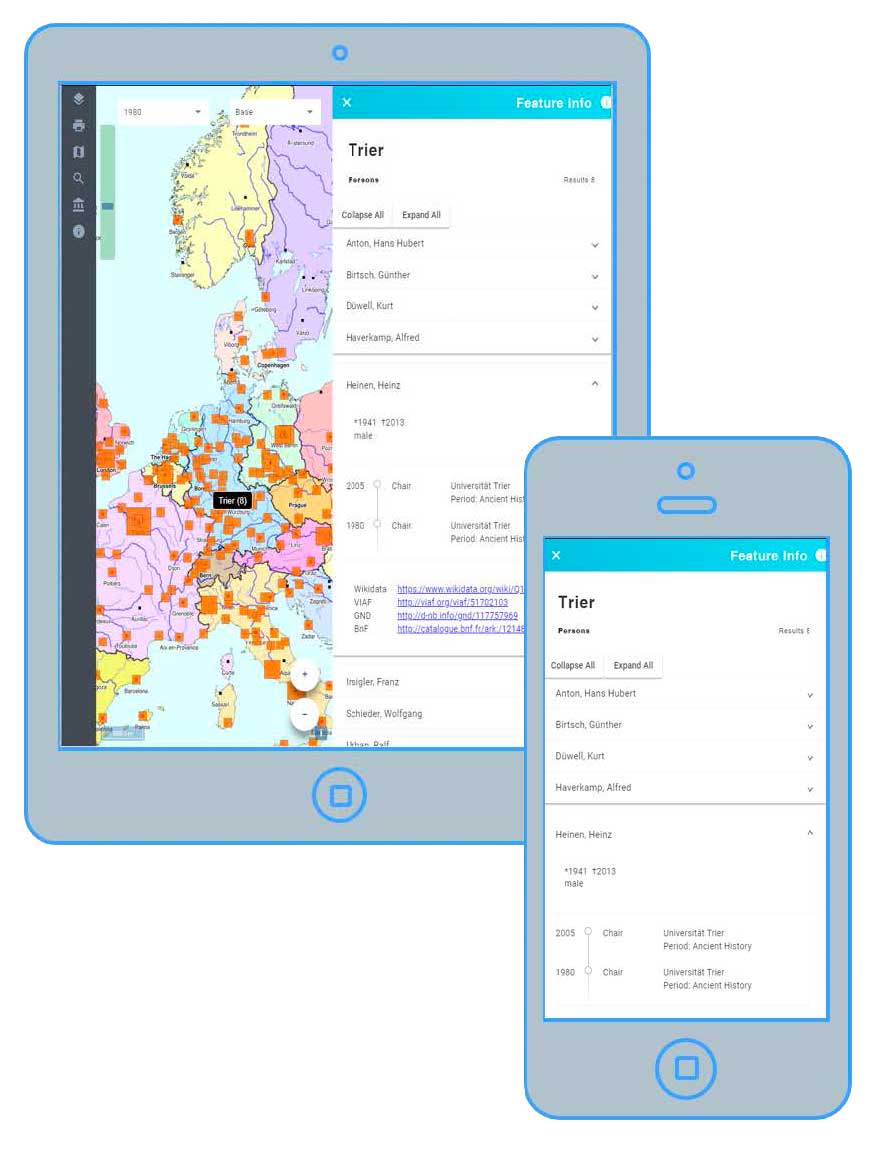
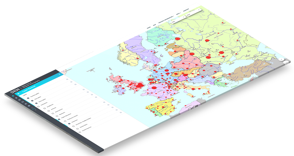
  • Online visualization using modern mapping libraries for mobile devices
    (OpenLayers5)

Please note that this project is work in progress. We invite you to contact us if you can provide further information to the underlying data or want to leave us a comment on the usability or the Digital Atlas in general.

Legal Notice | 
Data policy